Back to RasterLite2 Tutorials index
Tutorial: building and testing the Tabula Peutingeriana sample
RasterLite2 has the capability to even store big images completely lacking any kind of georeferencing.In this very peculiar case a special Reference System will be applied, identified by SRID=-1 and simply corresponding to a generic, absolutely unqualified Cartesian planar space and just supporting pixels as the internal measure unit.
Corollary: every non-georeferenced big image will be considered in a Reference System of its own; the origin coordinates 0,0 will always be placed on the lower left corner of the image. Consequently any attempt to overlap or join two different images into the same SRID=-1 Reference System will be completely meaningless and will certainly produce odd and unpredictable results.
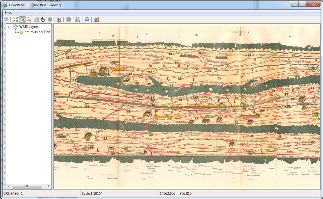
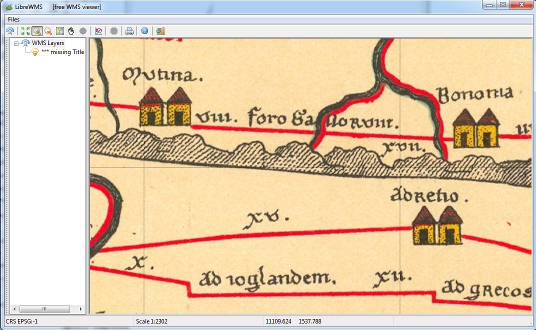
The Tabula Peutingeriana is a very interesting historical map, and is universally reputed to be a very accurate and faithful copy of some unknown original map probably dating back to the times of Emperor Augustus. It's not based on a topographical representation of the usual modern type, it's much more a topological representation; anyway it represents in full detail the road network connecting the ancient Roman Empire.
Georeferencing such a map is obviously impossible: anyway it could be easily loaded as an hi-quality, hi-resolution digital big image stored within a RasterLite2 DB-file.
Step 1) downloading the input datasource
You can easily download an accurate hi-resolution digital copy of the Tabula Peutingeriana; it's licensed on the Public Domain (CC-0) and it's absolutely free.
Step 2) creating the Peutingeriana Coverage
$ rl2tool CREATE -db peutingeriana.sqlite -cov peutingeriana -smp UINT8 \
-pxl RGB -cpr JPEG -srid -1 -res 1.0

rl2_tool: request is CREATE
===========================================================
              DB path: peutingeriana.sqlite
             Coverage: peutingeriana
          Sample Type: UINT8
           Pixel Type: RGB
      Number of Bands: 3
          Compression: JPEG (lossy)
  Compression Quality: 80
   Tile size (pixels): 512 x 512
    Not Georeferenced:
Pixel base resolution: X=1.0 Y=1.0
===========================================================

     SQLite version: 3.8.4.2
 SpatiaLite version: 4.2.0-devel
RasterLite2 version: 0.8

Raster Coverage "peutingeriana" successfully created

Operation CREATE successfully completed
$
You'll now invoke rl2tool CREATE exactly in the same way you've already tested in any previous tutorial; the relevant differences are in that:
- -srid -1: this explicit intends a non-georeferenced Coverage.
- -res 1.0: this simply confirms that the measure unit will exactly correspond to 1 pixel.
Step 3) populating the Peutingeriana Coverage
$ rl2tool IMPORT -db peutingeriana.sqlite -cov peutingeriana \
-srid -1 -src Tabula_Peutingeriana_-_Miller.jpg -pyr
rl2_tool; request is IMPORT
===========================================================
DB path: peutingeriana.sqlite
Input Source path: Tabula_Peutingeriana_-_Miller.jpg
Coverage: peutingeriana
Section: from file name
Immediately building Pyramid Levels
===========================================================
SQLite version: 3.8.4.2
SpatiaLite version: 4.2.0-devel
RasterLite2 version: 0.8
Importing: Tabula_Peutingeriana_-_Miller.jpg
------------------
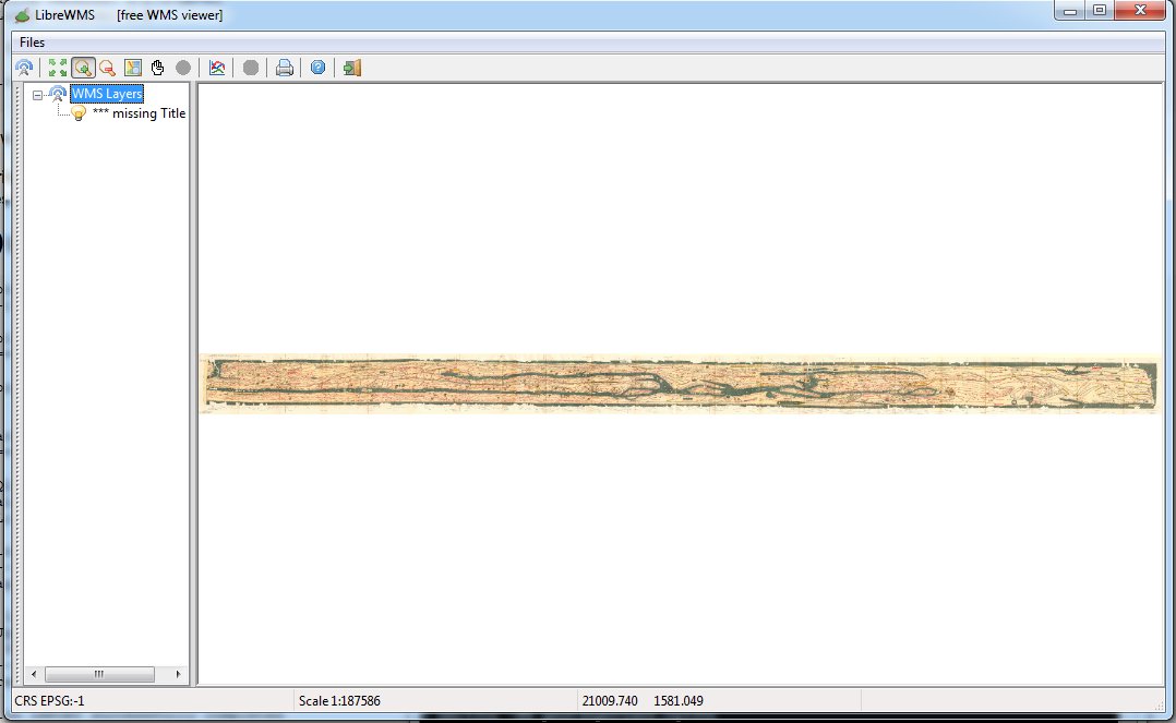
Image Size (pixels): 46380 x 2953
SRID: -1
LowerLeft Corner: X=0.00 Y=0.00
UpperRight Corner: X=46379.00 Y=2952.00
Pixel resolution: X=1.0 Y=1.0
----------
Pyramid levels successfully built for: Tabula_Peutingeriana_-_Miller
Operation IMPORT successfully completed
$
Once again, you'll invoke rl2tool IMPORT in the most usual way; you are simply required to specify yet another time -srid -1 so to explicitly confirm that this one is a peculiar non-georeferenced big image.
Step 4) testing the Peutingeriana sample
As you've already done in any previous tutorial you can now directly test the Peutingeriana Coverage by publishing a standard WMS service.You simply have to start the wmslite light-weight server, then connecting some WMS viewer (e.g. LibreWMS) to the service being published on localhost aka IP address 127.0.0.1, port 8080.
Back to RasterLite2 Tutorials index