
Importing / Exporting Shapefiles (DBF, TXT ...)
Note: these pages are no longer maintainedNever the less, much of the information is still relevant.Beware, however, that some of the command syntax is from older versions, and thus may no longer work as expected. Also: external links, from external sources, inside these pages may no longer function. |
|
Importing / Exporting Shapefiles (DBF, TXT ...) |
| 2011 January 28 |
| Previous Slide | Table of Contents | Next Slide |
|
There are several data formats that are absolutely
widespread in the GIS professional world. All them are open formats (i.e. they are not specifically bounded to any specific proprietary software, they are not patent covered, and they are publicly documented). Not at all surprisingly, such formats are universally supported by any GIS-related software, and can be safely used for data interchange purposes between different platforms and systems.
Please note well: other data formats are very popular and widespread. e.g. the following ones:
i.e. some specific proprietary software or operating system is strictly required, there is no publicly available documentation, and/or they are patent covered. And all this easily explains why SpatiaLite (as many others open source packages) cannot support such closed formats. |
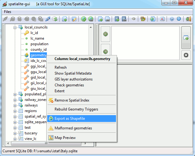
Shapefiles
SpatiaLite supports both import and export for Shapefiles: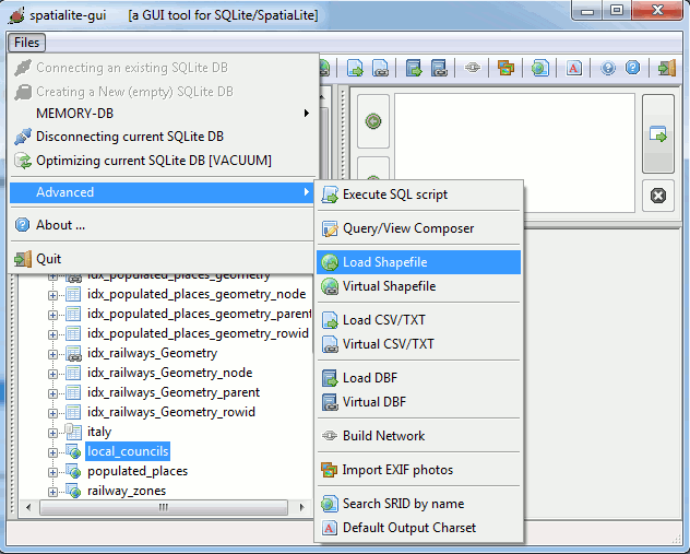
|
>
spatialite counties.sqlite SpatiaLite version ..: 2.4.0-RC5 Supported Extensions: - 'VirtualShape' [direct Shapefile access] - 'VirtualDbf' [direct DBF access] - 'VirtualText' [direct CSV/TXT access] - 'VirtualNetwork' [Dijkstra shortest path] - 'RTree' [Spatial Index - R*Tree] - 'MbrCache' [Spatial Index - MBR cache] - 'VirtualFDO' [FDO-OGR interoperability] - 'SpatiaLite' [Spatial SQL - OGC] PROJ.4 version ......: Rel. 4.7.1, 23 September 2009 GEOS version ........: 3.3.0-CAPI-1.7.0 SQLite version ......: 3.7.4 Enter ".help" for instructions spatialite> .loadshp prov2010_s counties CP1252 23032 the SPATIAL_REF_SYS table already contains some row(s) ======== Loading shapefile at 'prov2010_s' into SQLite table 'counties' BEGIN; CREATE TABLE counties ( PK_UID INTEGER PRIMARY KEY AUTOINCREMENT, "OBJECTID" INTEGER, "COD_PRO" INTEGER, "NOME_PRO" TEXT, "SIGLA" TEXT); SELECT AddGeometryColumn('counties', 'Geometry', 23032, 'MULTIPOLYGON', 'XY'); COMMIT; Inserted 110 rows into 'counties' from SHAPEFILE ======== spatialite> .headers on spatialite> SELECT * FROM counties LIMIT 5; PK_UID|OBJECTID|COD_PRO|NOME_PRO|SIGLA|Geometry 1|1|1|Torino|TO| 2|2|2|Vercelli|VC| 3|3|3|Novara|NO| 4|4|4|Cuneo|CN| 5|5|5|Asti|AT| spatialite> |
|
spatialite>
.dumpshp counties Geometry exported_counties CP1252 ======== Dumping SQLite table 'counties' into shapefile at 'exported_counties' SELECT * FROM "counties" WHERE GeometryAliasType("Geometry") = 'POLYGON' OR GeometryAliasType("Geometry") = 'MULTIPOLYGON' OR "Geometry" IS NULL; Exported 110 rows into SHAPEFILE ======== spatialite> .quit > |
|
>
spatialite_tool -i -shp prov2010_s -d db.sqlite -t counties -c CP1252 -s 23032 SQLite version: 3.7.4 SpatiaLite version: 2.4.0-RC5 Inserted 110 rows into 'counties' from 'prov2010_s.shp' > |
|
>
spatialite_tool -e -shp exported_counties -d db.sqlite -t counties -g Geometry -c CP1252 SQLite version: 3.7.4 SpatiaLite version: 2.4.0-RC5 Exported 110 rows into 'exported_counties.shp' from 'counties' > |
DBF files
SpatiaLite simply supports import for DBF files: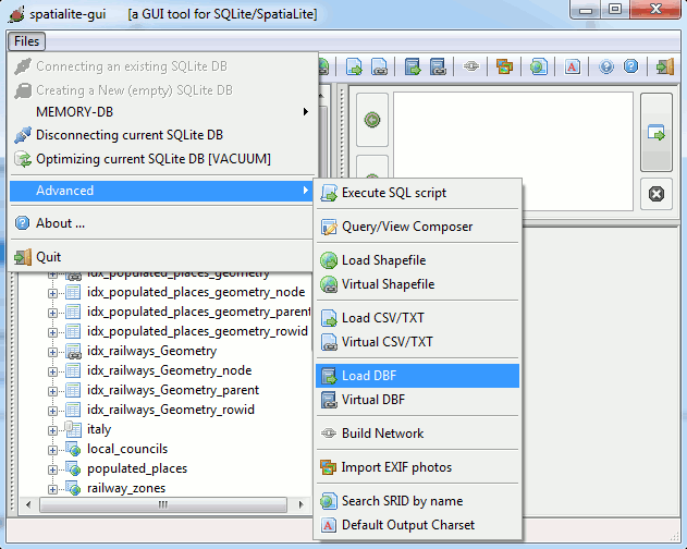
|
>
spatialite local_councils.sqlite SpatiaLite version ..: 2.4.0-RC5 Supported Extensions: - 'VirtualShape' [direct Shapefile access] - 'VirtualDbf' [direct DBF access] - 'VirtualText' [direct CSV/TXT access] - 'VirtualNetwork' [Dijkstra shortest path] - 'RTree' [Spatial Index - R*Tree] - 'MbrCache' [Spatial Index - MBR cache] - 'VirtualFDO' [FDO-OGR interoperability] - 'SpatiaLite' [Spatial SQL - OGC] PROJ.4 version ......: Rel. 4.7.1, 23 September 2009 GEOS version ........: 3.3.0-CAPI-1.7.0 SQLite version ......: 3.7.4 Enter ".help" for instructions spatialite> .loaddbf com2010_s.dbf local_councils CP1252 ======== Loading DBF at 'com2010_s.dbf' into SQLite table 'local_councils' BEGIN; CREATE TABLE local_councils ( PK_UID INTEGER PRIMARY KEY AUTOINCREMENT, "OBJECTID" INTEGER, "COD_REG" INTEGER, "COD_PRO" INTEGER, "COD_COM" INTEGER, "PRO_COM" INTEGER, "NOME_COM" TEXT, "NOME_ITA" TEXT, "NOME_TED" TEXT); COMMIT; Inserted 8094 rows into 'local_councils' from DBF ======== spatialite> .headers on spatialite> SELECT * FROM local_councils LIMIT 5 OFFSET 5000; PK_UID|OBJECTID|COD_REG|COD_PRO|COD_COM|PRO_COM|NOME_COM|NOME_ITA|NOME_TED 5001|4958|12|58|54|58054|Manziana|Manziana| 5002|4959|12|58|55|58055|Marano Equo|Marano Equo| 5003|4960|12|58|56|58056|Marcellina|Marcellina| 5004|4961|12|58|57|58057|Marino|Marino| 5005|4962|12|58|58|58058|Mazzano Romano|Mazzano Romano| spatialite> .quit > |
|
>
spatialite_tool -i -dbf com2010_s -d db.sqlite -t local_councils -c CP1252 SQLite version: 3.7.4 SpatiaLite version: 2.4.0-RC5 Inserted 8094 rows into 'local_councils' from 'com2010_s.dbf' > |
TXT/CSV files
SpatiaLite supports both import and export for TXT/CSV files: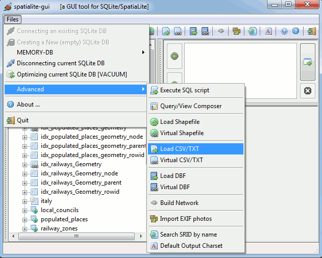
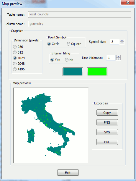
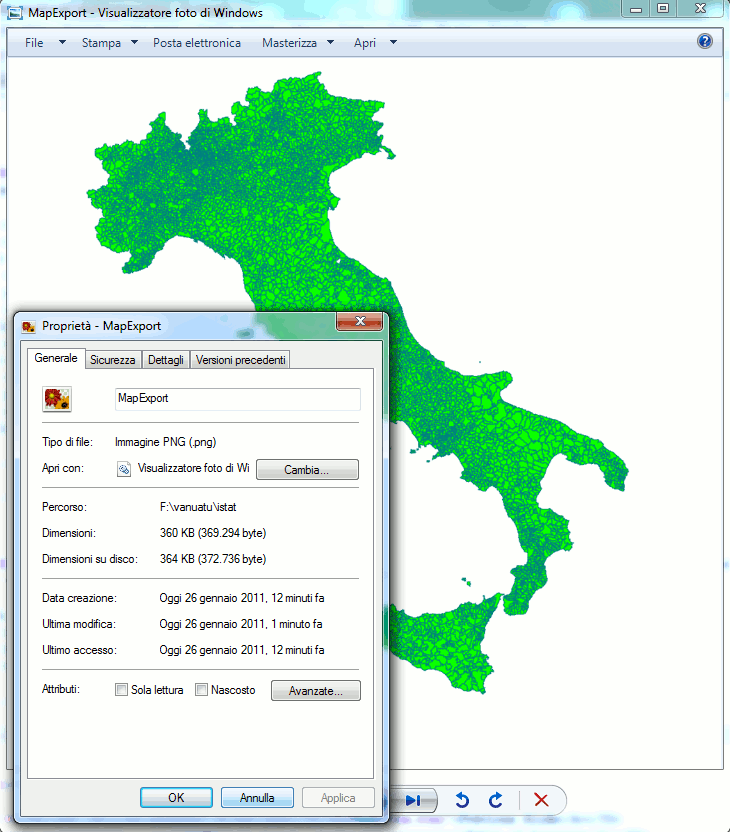
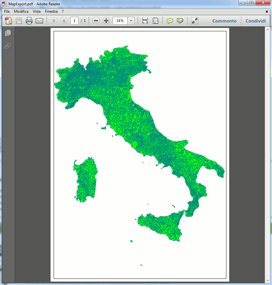
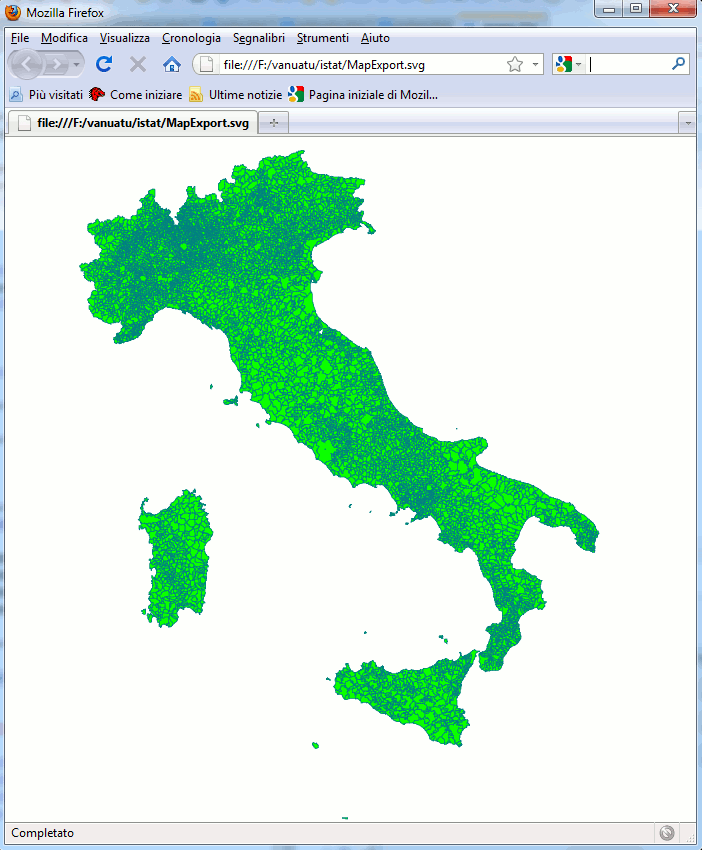
Other supported export formats
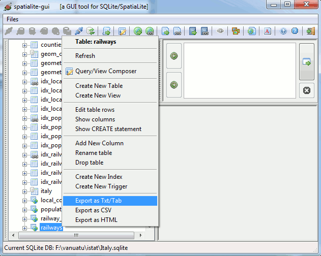
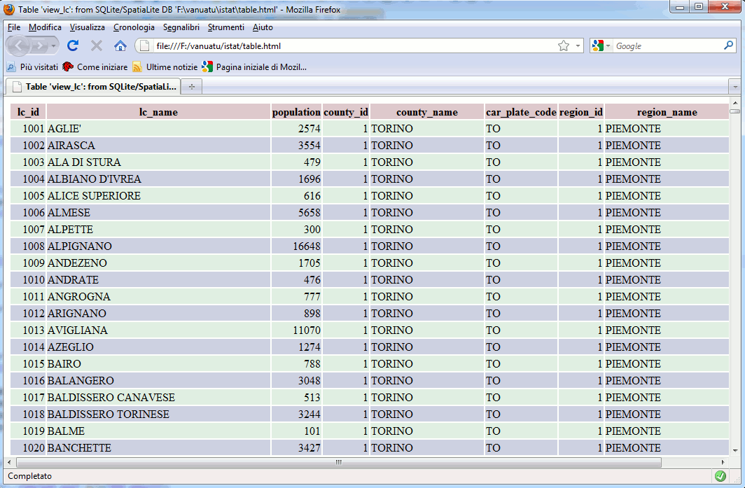
Using spatialite_gui you can also export your data as: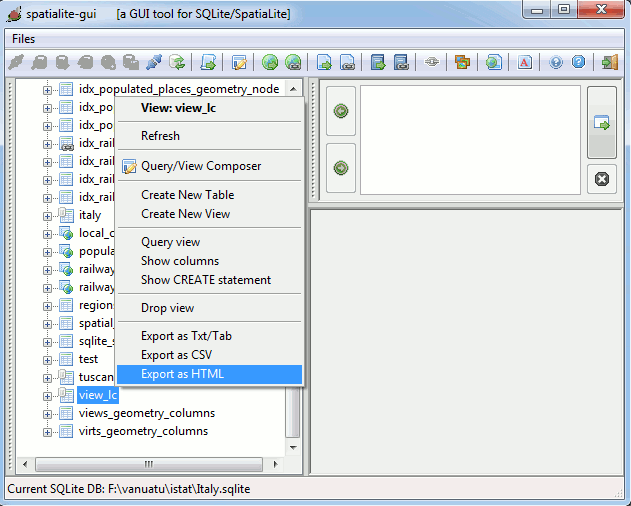
| Previous Slide | Table of Contents | Next Slide |

| Author: Alessandro Furieri a.furieri@lqt.it |
| This work is licensed under the Attribution-ShareAlike 3.0 Unported (CC BY-SA 3.0) license. | |
 |
Permission is granted to copy, distribute and/or modify this document under the terms of the GNU Free Documentation License, Version 1.3 or any later version published by the Free Software Foundation; with no Invariant Sections, no Front-Cover Texts, and no Back-Cover Texts. |