
Fine dining experience: Chez Dijkstra
Note: these pages are no longer maintainedNever the less, much of the information is still relevant.Beware, however, that some of the command syntax is from older versions, and thus may no longer work as expected. Also: external links, from external sources, inside these pages may no longer function. |
|
Fine dining experience: Chez Dijkstra |
| 2011 January 28 |
| Previous Slide | Table of Contents | Next Slide |
|
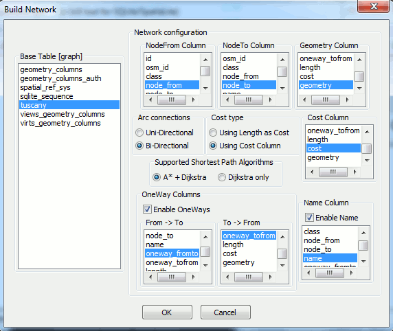
SpatiaLite supports an internal routing module called
VirtualNetwork Starting from an arbitrary network this module allows to identify shortest path connections using simple SQL queries. The VirtualNetwork module supports sophisticated and highly optimized algorithms, so it's really fast and very efficient even using huge sized networks. |
|
Network foundations You cannot assume that any generic road layer corresponds to a network.A real network must satisfy several specific prerequisites, i.e. it has to be a graph. Graph theory is a wide and complex branch of mathematics; if you are interested in this, here you can get some further details: Graph Theory Shortest Path Problem Dijkstra's Algorithm A* Algorithm 
Very shortly explained:
|
|
There are several sources distributing network-like data. One of the most renowned and widely used is OSM [Open Street Map], a completely free worldwide dataset. There are several download sites distributing OSM; just to mention the main ones: Anyway in the following example we'll download the required OSM dataset from: www.gfoss.it Most precisely we'll download the TOSCANA.osm.bz2 dataset. |
|
>spatialite_osm_net -o TOSCANA.osm -d tuscany.sqlite -T tuscany -m SQLite version: 3.7.4 SpatiaLite version: 2.4.0-RC5 using IN-MEMORY database Loading OSM nodes ... wait please ... Loaded 1642867 OSM nodes Verifying OSM ways ... wait please ... Verified 60893 OSM ways Disambiguating OSM nodes ... wait please ... Found 40 duplicate OSM nodes - fixed !!! Loading network ARCs ... wait please ... Loaded 121373 network ARCs Dropping temporary table 'osm_tmp_nodes' ... wait please ... Dropped table 'osm_tmp_nodes' Dropping index 'from_to' ... wait please ... Dropped index 'from_to' exporting IN_MEMORY database ... wait please ... IN_MEMORY database succesfully exported VACUUMing the DB ... wait please ... All done: OSM graph was succesfully loaded > |
|
SELECT * FROM tuscany; |
| id | osm_id | class | node_from | node_to | name | oneway_from_to | oneway_to_from | length | cost | geometry |
| ... | ... | ... | ... | ... | ... | ... | ... | ... | ... | ... |
| 2393 | 8079944 | tertiary | 659024545 | 659024546 | Via Cavour | 1 | 1 | 7.468047 | 0.537699 | BLOB sz=80 GEOMETRY |
| 2394 | 8079944 | tertiary | 659024546 | 156643876 | Via Cavour | 1 | 1 | 12.009911 | 0.864714 | BLOB sz=96 GEOMETRY |
| 2395 | 8083989 | motorway | 31527668 | 319386487 | Autostrada del Sole | 1 | 0 | 424.174893 | 13.882087 | BLOB sz=80 GEOMETRY |
| 2396 | 8083990 | motorway | 31527665 | 31527668 | Autostrada del Sole | 1 | 0 | 130.545183 | 4.272388 | BLOB sz=112 GEOMETRY |
| ... | ... | ... | ... | ... | ... | ... | ... | ... | ... | ... |
|
SELECT * FROM tuscany_net WHERE NodeFrom = 267209305 AND NodeTo = 267209702; |
| Algorithm | ArcRowid | NodeFrom | NodeTo | Cost | Geometry | Name |
| Dijkstra | NULL | 267209305 | 267209702 | 79.253170 | BLOB sz=272 GEOMETRY | NULL |
| Dijkstra | 11815 | 267209305 | 250254381 | 11.170037 | NULL | Via Guelfa |
| Dijkstra | 11816 | 250254381 | 250254382 | 8.583739 | NULL | Via Guelfa |
| Dijkstra | 11817 | 250254382 | 250254383 | 12.465016 | NULL | Via Guelfa |
| Dijkstra | 16344 | 250254383 | 256636073 | 15.638407 | NULL | Via Cavour |
| Dijkstra | 67535 | 256636073 | 270862435 | 3.147105 | NULL | Piazza San Marco |
| Dijkstra | 25104 | 270862435 | 271344268 | 5.175379 | NULL | Piazza San Marco |
| Dijkstra | 25105 | 271344268 | 82591712 | 3.188657 | NULL | Piazza San Marco |
| Dijkstra | 11802 | 82591712 | 267209666 | 4.978328 | NULL | Piazza San Marco |
| Dijkstra | 20773 | 267209666 | 267209702 | 14.906501 | NULL | Via Giorgio La Pira |
|
UPDATE tuscany_net SET Algorithm = 'A*';
UPDATE tuscany_net SET Algorithm = 'Dijkstra'; |
|
A VirtualNetwork
table simply represents a staticized snapshot of the
underlying network. This allows to adopt an highly efficient binary representation (in other words, allows to produce solutions in a very quick time), but obviously doesn't supports dynamic changes. Each time the underlying network changes the corresponding VirtualNetwork must be DROPped and then created again, so to correctly reflect the latest network state. In many cases this isn't an issue at all: but on some highly dynamic scenario this may be a big annoyance. Be well conscious of this limitation. |
| Previous Slide | Table of Contents | Next Slide |

| Author: Alessandro Furieri a.furieri@lqt.it |
| This work is licensed under the Attribution-ShareAlike 3.0 Unported (CC BY-SA 3.0) license. | |
 |
Permission is granted to copy, distribute and/or modify this document under the terms of the GNU Free Documentation License, Version 1.3 or any later version published by the Free Software Foundation; with no Invariant Sections, no Front-Cover Texts, and no Back-Cover Texts. |