
Importer / Exporter les Shapefiles (DBF, TXT ...)
Février 2011
|
|
Importer / Exporter les Shapefiles (DBF, TXT ...) |
|
Février 2011 |
|
Il existe de nombreux formats de données largement répandus
dans le monde des SIG.
SpatiaLite supporte tous ces formats pour l'import/export.
ce sont tous des formats propriétaires. |
Shapefiles
SpatiaLite supporte l'importation et l'exportation de Shapefiles:
il est possible d'y accéder directement via les tables VirtualShapefile
il est possible de les importer dans la BDD:
dans spatialite_gui vous trouverez un bouton Load Shapefile dans la barre de menu.
en ligne de commande, vous pouvez utiliser la macro .loadshp
vous pouvez aussi utiliser la console spatialite_tool
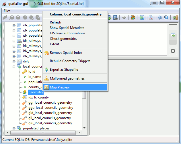
il est possible d'exporter des tables en Shapefile:
dans spatialite_gui vous trouverez un bouton Export As Shapefile dans le menu contextuel de chaque colonne géométrique (clic droit).
en ligne de commande, en utilisant la macro .dumpshp
via spatialite_tool
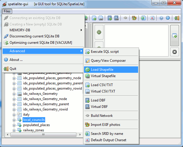
spatialite_gui:
Shapefile import 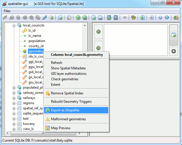
spatialite_gui:
Shapefile export
|
>
spatialite
counties.sqlite |
spatialite ligne de commande: shapefile import
|
spatialite>
.dumpshp
counties Geometry exported_counties CP1252 |
spatialite ligne de commande: shapefile export
|
>
spatialite_tool -i -shp prov2010_s -d db.sqlite -t counties -c
CP1252 -s 23032 |
spatialite_tool : shapefile import
|
>
spatialite_tool -e -shp exported_counties -d db.sqlite -t counties
-g Geometry -c CP1252 |
spatialite_tool : shapefile export
fichiers DBF
SpatiaLite supporte uniquement l'import de fichiers DBF:
acces direct via les tables VirtualDbf
importation dans la BDD:
dans spatialite_gui via le bouton Load DBF.
uen ligne de commande via la macro .loaddbf
via spatialite_tool
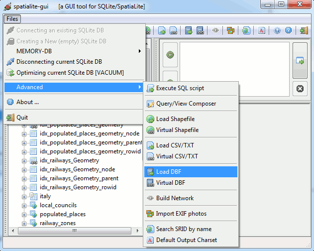
spatialite_gui:
DBF import
|
>
spatialite
local_councils.sqlite |
spatialite ligne de commande: DBF import
|
>
spatialite_tool -i -dbf com2010_s -d db.sqlite -t local_councils
-c CP1252 |
spatialite_tool : DBF import
fichiers TXT/CSV
SpatiaLite supporte l'import et l'export de fichiers TXT/CSV:
acces direct via les tables VirtualText
import dans une BDD:
dans spatialite_gui via le bouton Load TXT/CSV du menu.
export de table vers TXT/CSV:
dans spatialite_gui via le bouton Export As TXT/CSV dans le menu contextuel de chaque table
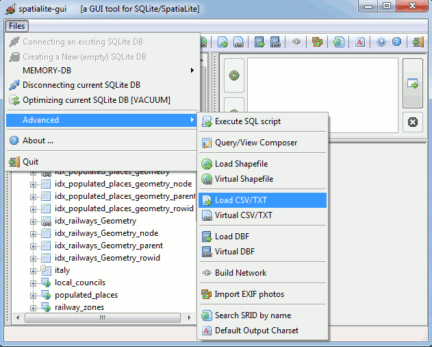
spatialite_gui:
TXT/CSV import 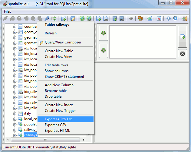
spatialite_gui:
TXT/CSV export
Autres formats supportés
Avec spatialite_gui vous pouvez également exporter vos données en:
HTML (pages web)
PNG images (Geometries)
PDF documents (Geometries)
SVG vector graphics (Geometries)
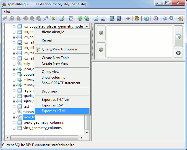
spatialite_gui:
HTML export 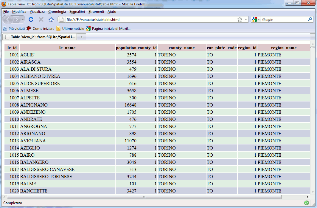
HTML export
spatialite_gui:
PNG / PDF / SVG export (1) 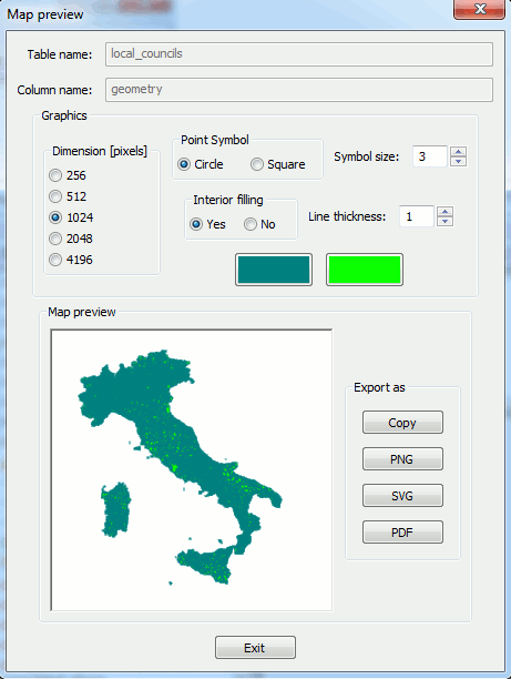
spatialite_gui:
PNG / PDF / SVG export (2)
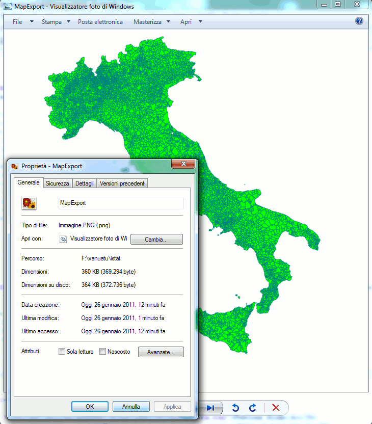
PNG export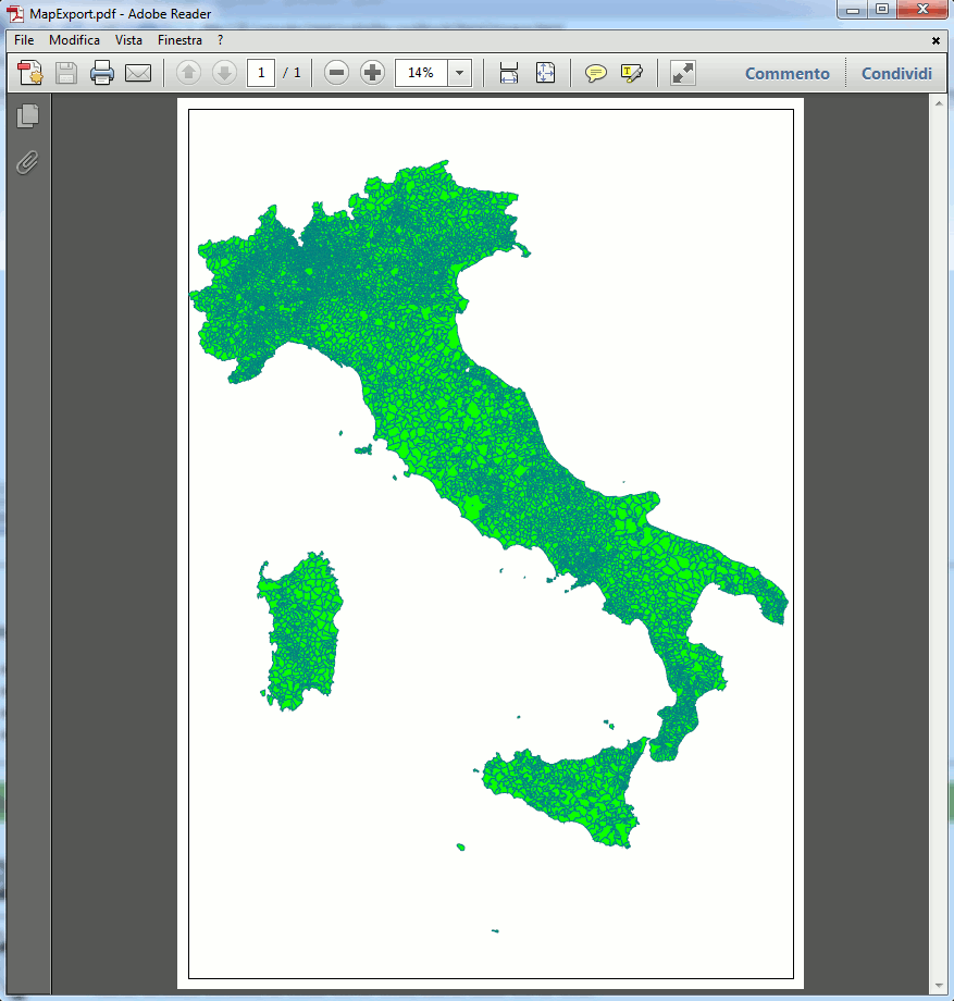
PDF export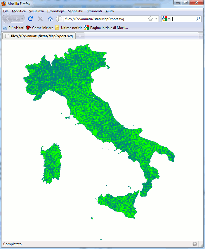
SVG export
|
|
Author: Alessandro Furieri a.furieri@lqt.it |
|
This work is licensed under the Attribution-ShareAlike 3.0 Unported (CC BY-SA 3.0) license. |
|
|
|
|
|
|
Permission is granted to copy, distribute and/or modify this
document under the terms of the |